Facility planning & exploration
ITN Facility
Planner
See where your assets are.
Explore how your facility works.
Bring layouts, tagged equipment and guided visits together in an interactive facility view. Build in 2D, review in 3D, and make your spaces easier to understand.
Early release · Fictional Nexora Chemicals sample
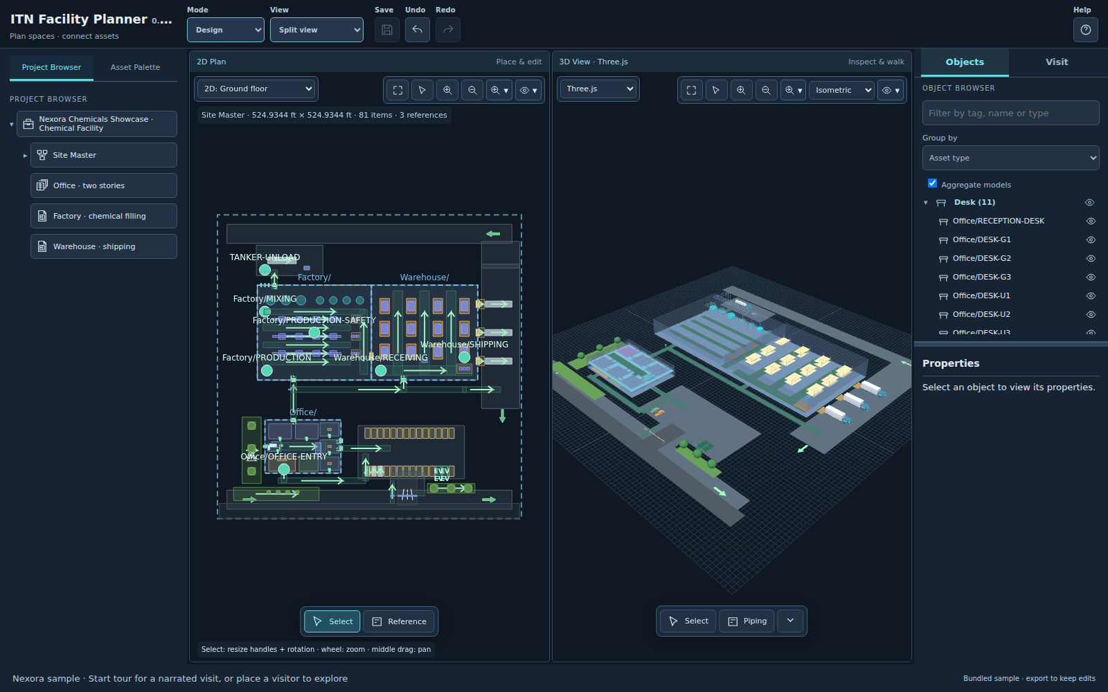
Place rooms, equipment and pathways in 2D
Find tagged assets in their physical context
Inspect floors and walk through the facility
Create narrated routes for visitors and teams
The business value
Give facility information a place people can see.
A drawing shows a layout. A business system holds records. ITN Facility Planner provides a visual place to bring those things together, helping people understand both the asset and its surroundings.
Find the right asset
Search by tag, select equipment and inspect its location. Navigate the current model through an object browser, with visibility controls for assets and floors.
Review an arrangement
Build office, factory, warehouse and yard layouts as separate pieces, then reference them into a master. See the result in 3D as you refine the plan.
Explain the facility
Define guided visits with narration stops, routes, floor changes and safety-gear prompts. Give people a way to explore before their physical visit.
Explore the actual application
Start with a complete sample campus.
Nexora Chemicals includes a two-story office, chemical mixing and storage tanks, filling lines, warehouse racks, truck docks and outdoor circulation. It is fictional demonstration content you can explore and adapt.
Your edits stay in your browser. Export a project to keep a file on your computer and import it later.
Connect it to your operation
A tank reading becomes easier to understand when you can see the tank.
Imagine selecting a tagged tank and seeing its quantity, capacity and remaining space alongside its location and connected equipment. The sample illustrates this with demonstration readings; customer data connections are configured as an integration project.
Existing systems
Use asset identity and tags to connect records in your application to the facility view. Discuss API or desktop-host integration around the data you already maintain.
Two 3D perspectives
Use Three.js for local facility exploration or Cesium for a geographically positioned view. Both share the planner model. External map imagery, terrain and survey datasets require additional integration.
Start with one area
Bring an office plan, a warehouse zone or a production area. Define the assets and the first useful workflow, then expand the model as you validate its value.
Start with schematic planning and exploration, then refine the model using your drawings, measured dimensions and asset data.
Your facility, your workflow